
קובץ:South Africa Western Cape relief location map.svg

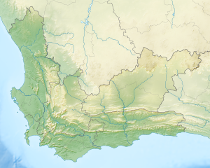
גודל התצוגה המקדימה הזאת מסוג PNG של קובץ ה־SVG הזה: 749 × 600 פיקסלים. רזולוציות אחרות: 300 × 240 פיקסלים | 600 × 480 פיקסלים | 959 × 768 פיקסלים | 1,279 × 1,024 פיקסלים | 2,558 × 2,048 פיקסלים | 1,214 × 972 פיקסלים.
לקובץ המקורי (קובץ SVG, הגודל המקורי: 1,214 × 972 פיקסלים, גודל הקובץ: 1.98 מ"ב)
| זהו קובץ שמקורו במיזם ויקישיתוף. תיאורו בדף תיאור הקובץ המקורי (בעברית) מוצג למטה. |
| תיאור |
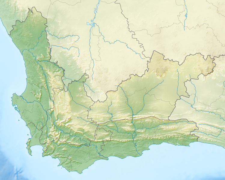
English: Relief location map of the Western Cape
Equirectangular projection, N/S stretching 118%. Geographic limits of the map:
|
| תאריך יצירה | |
| מקור |
|
| יוצר | Htonl |
| אישורים והיתרים (שימוש חוזר בקובץ זה) |
אני, בעל זכויות היוצרים על עבודה זו, מפרסם בזאת את העבודה תחת הרישיון הבא: הקובץ הזה מתפרסם לפי תנאי רישיון קריאייטיב קומונז ייחוס-שיתוף זהה 3.0 לא מותאם.
|
| גרסאות אחרות | File:South Africa Western Cape location map.svg |
היסטוריית הקובץ
ניתן ללחוץ על תאריך/שעה כדי לראות את הקובץ כפי שנראה באותו זמן.
| תאריך/שעה | תמונה ממוזערת | ממדים | משתמש | הערה | |
|---|---|---|---|---|---|
| נוכחית | 22:44, 4 בינואר 2013 | | 972 × 1,214 (1.98 מ"ב) | Htonl | {{Information |Description ={{en|1=Relief location map of the Western Cape Equirectangular projection, N/S stretching 118%. Geographic limits of the map: * N: 30.25° S * S: 35.0° S * W: 17.5° E * E: 24.5° E}} |Source ... |
שימוש בקובץ
הדפים הבאים משתמשים בקובץ הזה:
שימוש גלובלי בקובץ
אתרי הוויקי השונים הבאים משתמשים בקובץ זה:
- שימוש באתר ar.wikipedia.org
- שימוש באתר ban.wikipedia.org
- שימוש באתר be.wikipedia.org
- שימוש באתר bg.wikipedia.org
- שימוש באתר ceb.wikipedia.org
- שימוש באתר de.wikipedia.org
- Tafelbucht
- Boulders Beach
- Saldanha Bay
- Montagu-Pass
- Wikipedia:Kartenwerkstatt/Positionskarten/Afrika
- Dyer Island (Südafrika)
- False Bay
- Vorlage:Positionskarte Südafrika Westkap
- Duiker Island
- Dassen Island
- Benutzer:Olga Ernst/Walker Bay (Südafrika)
- Walker Bay (Südafrika)
- Matroosberg
- Still Bay
- Sankt-Helena-Bucht
- Bergwerk Steenkampskraal
- שימוש באתר en.wikipedia.org
- Stellenbosch
- Cederberg
- False Bay
- Chapman's Peak
- Blombos Cave
- Dassen Island
- Rondevlei Nature Reserve
- Seal Island, South Africa
- Marloth Nature Reserve
- Karoo National Park
- Dimension Data Pro-Am
- BOS 400
- De Hoop Nature Reserve
- Duiker Island
- Hex River Mountains
- Arniston (East Indiaman)
- Boosmansbos Wilderness Area
- Johanna (East Indiaman)
- Module:Location map/data/South Africa Western Cape/doc
- Coca-Cola Charity Championship
- Grootrivier Pass
- Akkedisberg Pass
- Attakwaskloof Pass